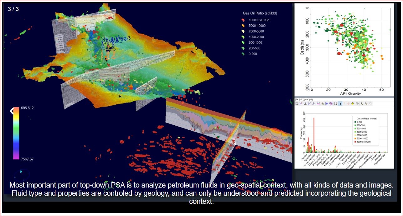
Sando uses Zetaware software (Kinex, Genesis 1D and Trinity 3T) for its petroleum system analysis, mapping tools, drawing block boundary, and merging well database with depth maps or other G&G maps to evaluate a basin. ArcGIS and/or Zetaware are also used for surface mapping and CCRS (Common Composite Risk Segments) maps (commonly known as traffic light maps) to identify low risk and high risk area.